
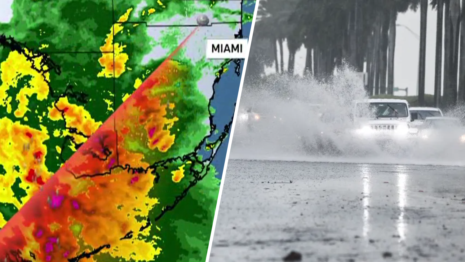
With excessive rain expected throughout South Florida, a flood watch will be in effect on Monday and will last until Tuesday morning.
The areas under the watch include the following:
Watch NBC6 free wherever you are
- Southeast Florida,
- Coastal Broward County
- Coastal Miami Dade County
- Coastal Palm Beach County
- Far South Miami-Dade County
- Inland Broward County
- Inland Miami-Dade County
- Inland Palm Beach County
- Metro Broward County
- Metro Palm Beach County
- Metropolitan Miami Dade
- Glades
- Hendry
- Coastal Collier County
- Inland Collier County
- Mainland Monroe.
Active weather is gearing up to move into South Florida and a frontal boundary has been draped and stalled in the Gulf over the last several days.
Get local news you need to know to start your day with NBC 6's News Headlines newsletter.
Heading into Monday, it starts to get some movement and begins advancing toward the area.
The front should clear the area by Tuesday afternoon and dry air will return – but not before some very active weather.
Overnight tonight, showers and storms will start approaching the area from the west.
Weather Stories

Key West is expected to start seeing rain into the late night hours and by Monday morning, they will be knocking on the door for the rest of the area from the Everglades.
Monday, by mid to late morning showers and storms will be filling in across South Florida.
They will last into the afternoon and off and on through the evening.
Another round of active weather will come through overnight and into Tuesday morning before the front clears and dry air returns.
Maybe just a stray lingering shower Tuesday afternoon but overall improving weather as the day continues.
Slow moving rain will lead to ponding and flooding risks.
Ahead of the front, tropical like downpours are anticipated because of how much humidity there is to work with.
Widespread rainfall totals look to be 1” to 3” but in areas that see multiple heavy rounds of rain, totals can easily be 4’ to 6”.
This is going to bring flooding if it comes in a short amount of time but it will also be beneficial for the ongoing drought. South Florida is under the slight risk, level 2 out of 5, for flooding.
The highest concerns are for areas that see repeated training from the storms. Rainfall rates 1-3” per hour are expected.
On top of the flooding risk, the storms themselves could also create hazards.
All South Florida is under a marginal risk, level 1 out of 5, for severe storms.
Isolated storms could reach severe limits but all of us will have stormy weather.
Within the severe threats: Strong, gusty storm-winds could be upwards of 60 mph or greater. This may trigger a severe storm or two while they are in the area.
Additionally, an isolated tornado can’t be ruled out with the elevated shear that will be in the atmosphere.
There could also be small hail but with how warm things have been, this threat is much lower.